


UTILITY

MULTIMEDIA
DID YOU KNOW?
")
")
")

| Saints and Blessed of the Vicentinian Church | |
|
|
Ex voto sanctuaries |
| Unmissable places of faith | |
| Focus: the Church of Santa Corona in Vicenza - VIRTUAL TOUR | |
| Focus: the Sanctuary of Monte Berico - VIRTUAL TOUR Coming soon ( dec 2024) |

![]()
![]()
![]()

![]()

![]()
#visitVicenza #cuoreDelVeneto #vibike #iopedalovicentino
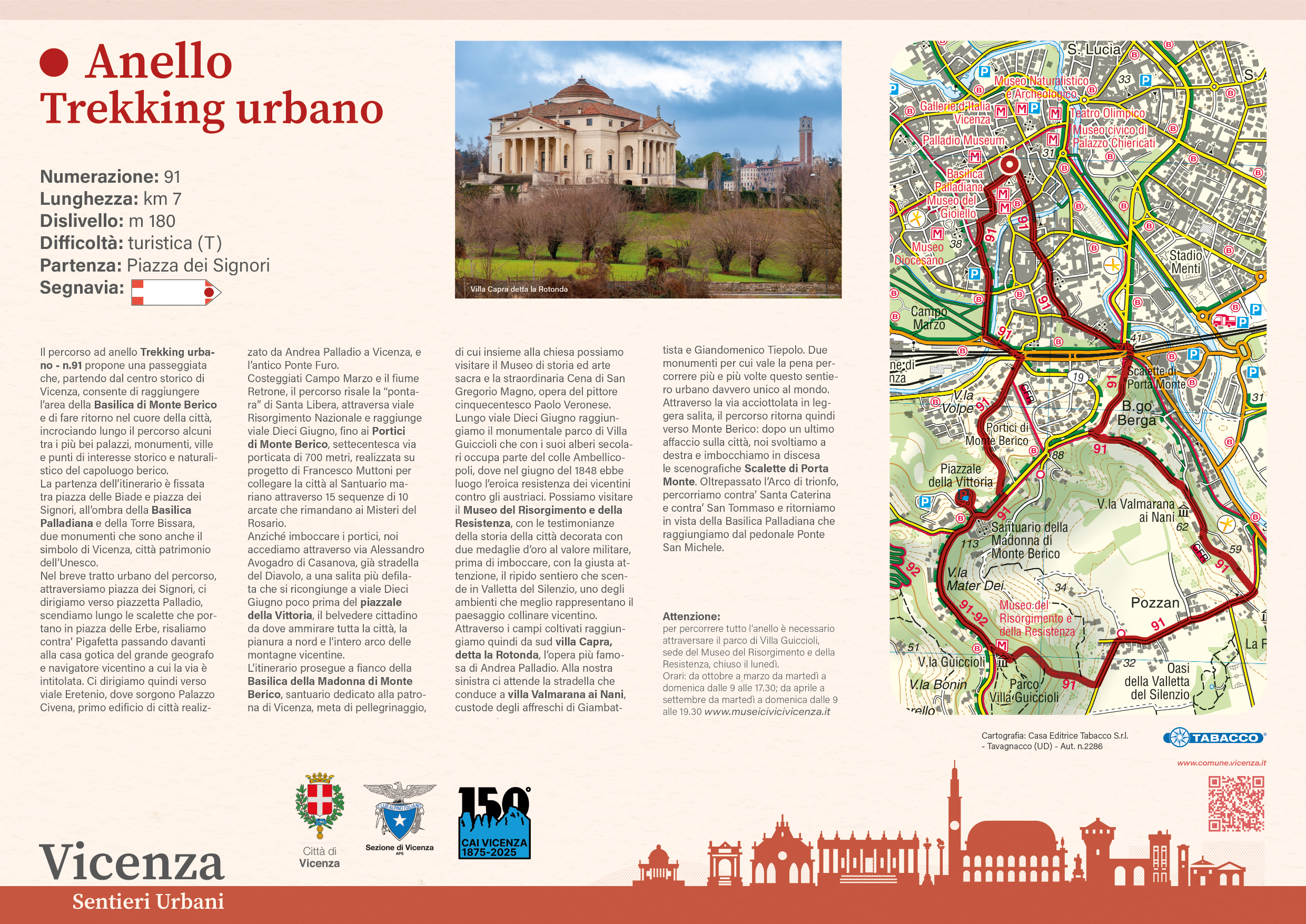
Loop itinerary Urban Trekking: download the map here
Identification number: 91
Length: km 7
Altitude difference: m 180
Difficulty: for tourists (T)
Starting point: Piazza dei Signori
Loop itinerary Monte Berico: download the map here
Identification number: 92
Length: km 6.85
Altitude difference: m 139
Difficulty: for tourists (T)
Starting point: Piazzale della Vittoria
Loop itinerary Parco Retrone: download the map here
Identification number: 93
Length: km 6.55
Altitude difference: none
Difficulty: for tourists (T)
Starting point: Entrance of Parco Retrone, from via Carta
Loop itinerary Nord Laghetto: download the map here
Identification number: 97
Length: km 7
Altitude difference: none
Difficulty: for tourists (T)
Starting point: Piazzale di via dei Laghi
Accessible to people with physical disabilities
Loop itinerary Monte Crocetta: download the map here
Identification number: 99
Length: km 4.3
Altitude difference: m 47
Difficulty: for tourists (T)
Starting point: Chiesa di San Giuseppe, in Maddalene
More information on the tracks is published on the official website of the City of Vicenza.